Chlorophyll Clues: Studying Nutrient Pollution at Kanaha Beach Park
Less obvious than ‘brown water events’ from big storms, groundwater is known to carry chemicals, sewage waste, and other contaminants into the ocean. It can also offer scientists and resource managers clues about the specific types of pollutants from a watershed and their sources. Previous scientific studies on Maui have shown that groundwater discharge is common along many shorelines and, that unfortunately, nutrient pollution is a widespread issue.
Since 2019, MNMRC has been collecting data on groundwater around Maui to improve its understanding of how it enters the ocean and find ways of reducing the toxic load that ends up on local reefs. The effort started as a small project in partnership with the County of Maui, using a Manta multi-sensor water probe to gather groundwater data in key coastal areas from Kahului to Kaupo. Since then, MNMRC has continued to collect coastal groundwater data around the island as it is able, primarily in West and South Maui.
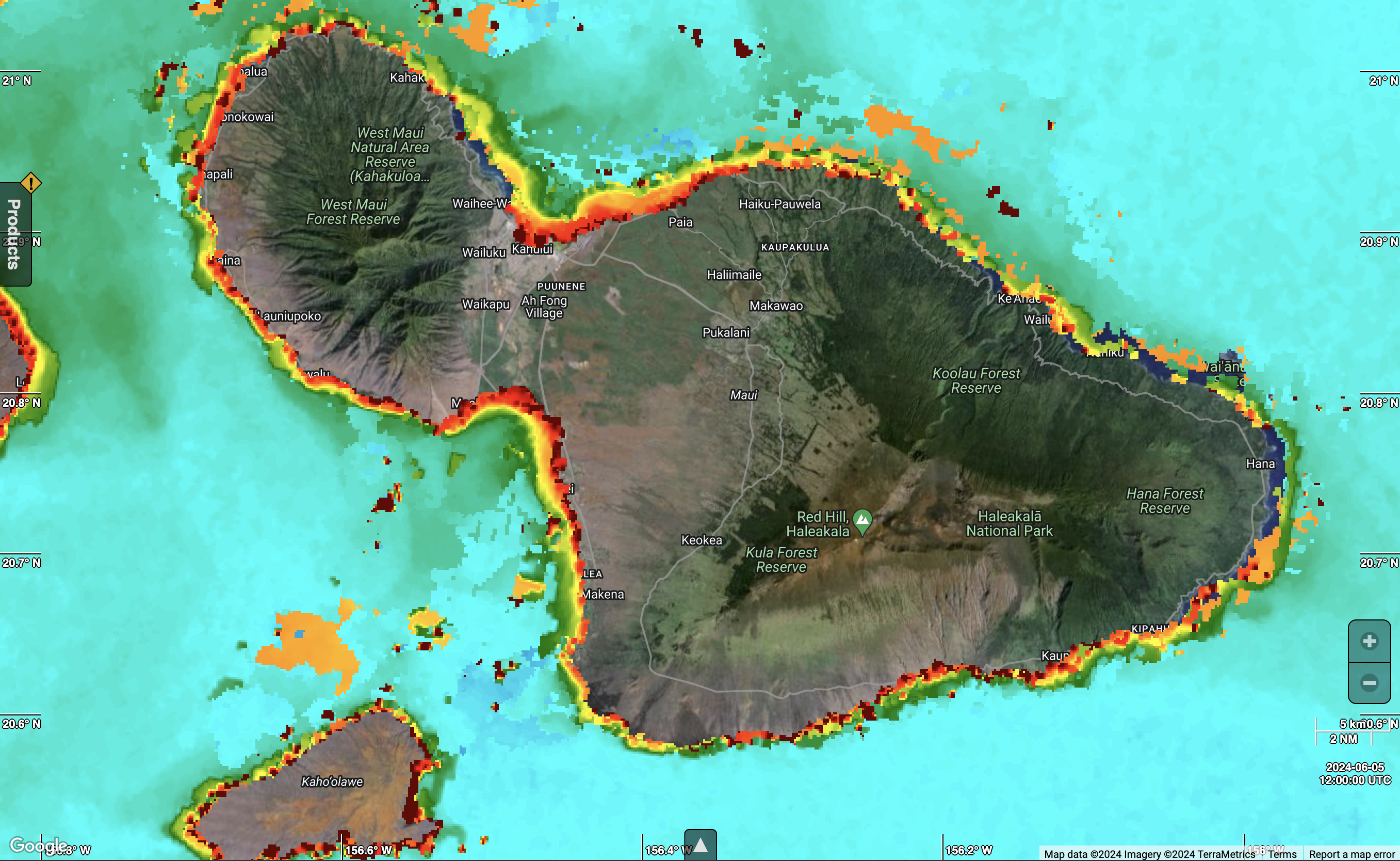
Satellite imagery showing chlorophyll levels from the European Space Agency’s Sentinel-3 OLCI. (Photo Credit: The European Space Agency)
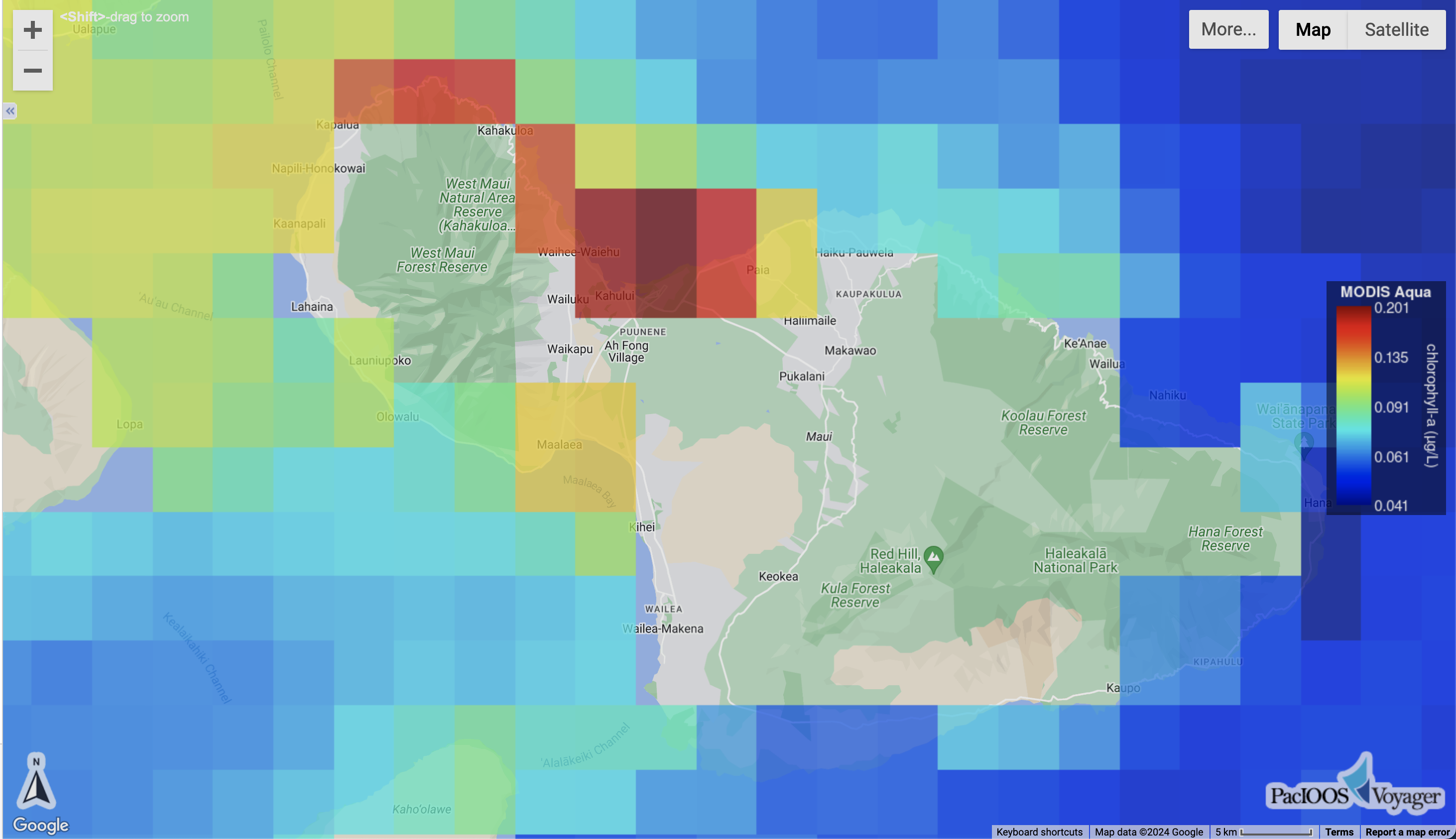
Satellite imagery showing chlorophyll levels from the PacIOOS MODIS Aqua. (Photo Credit: Pacific Islands Ocean Observing System)
While efforts to evaluate groundwater’s impact on Maui’s coastal waters have continued, the urban areas along the island’s North side have not been recently revisited. Imagery from both the European Space Agency’s Sentinel-3 OLCI satellite and NOAAs MODIS Aqua satellite repeatedly shows high levels of chlorophyll in the area off of Maui’s North Shore, suggesting that the nutrient pollution described by Daniel Amato and colleagues in 2016 continues to this day. Chlorophyll detected in tropical waters reveals the presence of floating microalgae that rapidly multiply when fertilized by the nutrients in groundwater. Closer to shore, nutrients can also cause blooms of larger limu species.
“At Kanaha, the satellite imagery suggests that nutrient enrichment attributed to the nearby wastewater treatment plant by the Amato study is affecting areas far offshore,” said Science Director John Starmer. The imagery also indicates that the treatment plant is not the only source, so we are looking to better understand the hydrology up and down the coast.”
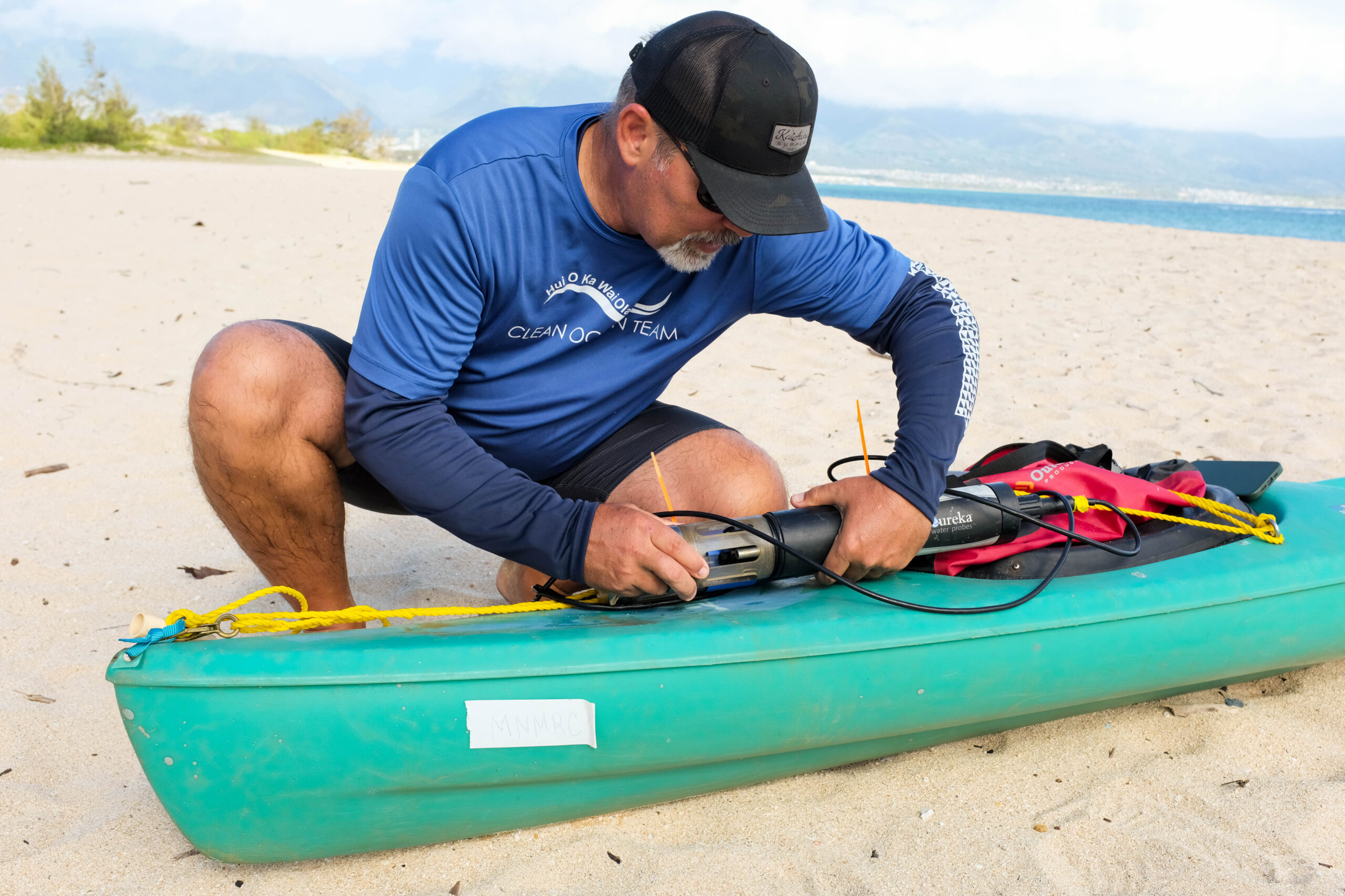
MNMRC’s Science Director, John Starmer assembles a Manta water sensor to test salinity at Kanaha Beach Park. (Photo Credit: Maui Nui Marine Resource Council)
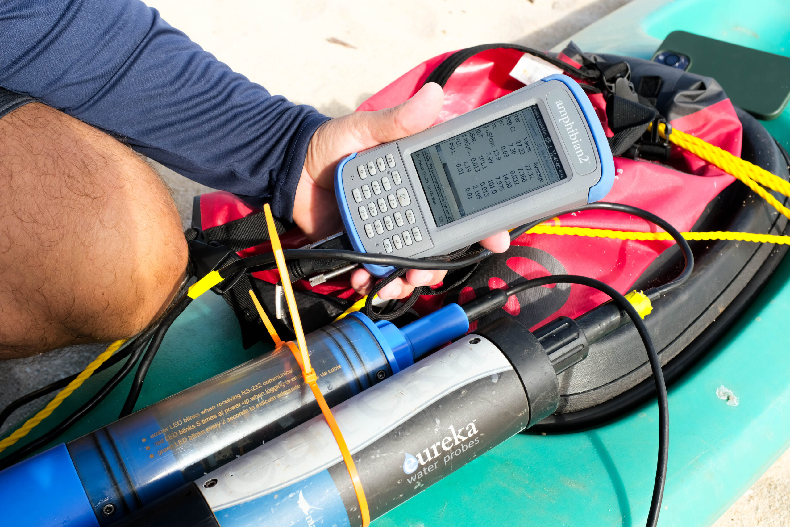
An amphibian2 device works in conjunction with the Manta to collect salinity and water temperature data. (Photo Credit: Maui Nui Marine Resource Council)
In a trial to involve community science to understand groundwater, data generated by athletes participating in the recent Epic Swim Maui event has helped fill the knowledge gap of groundwater presence in North Maui and other hard-to-reach places on the island. Swimmers were equipped with water sensors that captured salinity and temperature data as they circumnavigated the island in July 2024. MNMRC has made other informal attempts to collect data in North Maui through kayak tows closer to shore which can help shed light on where groundwater flow might be coming from. “It is clear that groundwater is flowing into the ocean all along the coast at Kanaha,” said Starmer. “The next step is to look for the indicators of the strongest groundwater flow. We won’t be able to test everything so we are focusing on finding areas with high groundwater and nutrient influence and then following up with additional testing.”
In addition to studying the impacts of groundwater in North Maui, MNMRC is also working to understand the flow of stormwater and its effects on coastal water quality. A proposed partnership with the National Fish and Wildlife Foundation (NFWF) could help fill gaps in knowledge around the relationship between surface and groundwater flow and allow MNMRC to undertake the additional steps needed to get a clearer idea of water quality conditions at Kanaha.
While groundwater can be an “invisible” problem, it can be equally harmful to our reefs as brown water events. “The big plumes of brown-water runoff we see during storms are obvious but acute signs of poor water quality,” said Starmer. “Because it’s usually clear, groundwater is a chronic but hidden issue—it’s always flowing and can be just as polluted as surface runoff. If we want to address the bigger issue of land-based pollution in our coastal waters, we will have to find solutions to both brown water and groundwater challenges around Maui.”

No Comments
Sorry, the comment form is closed at this time.